
- Ian Greenwood
- •
- powder.com
- •
- January 22, 2026
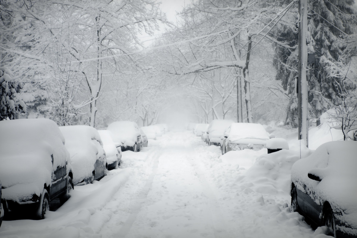
It's still dry out West, but ski resorts in Pennsylvania like Camelback Resort and Blue Mountain are preparing for what could be a memorable storm.
Earlier this week, Blue Mountain, known for being the largest ski resort in the state, shared a forecast from The Weather Channel showing forecasted snowfall totals of 12 to 18 inches from Saturday, January 24, through Monday, January 26, 2026. See below.
“Could this be the powder day we've been dreaming of?” the resort wondered. Keep reading for more.
The 2026 POWDER Photo Annual is here! Look for a print copy on a newsstand near you, or click here to have a copy shipped directly to your front door.
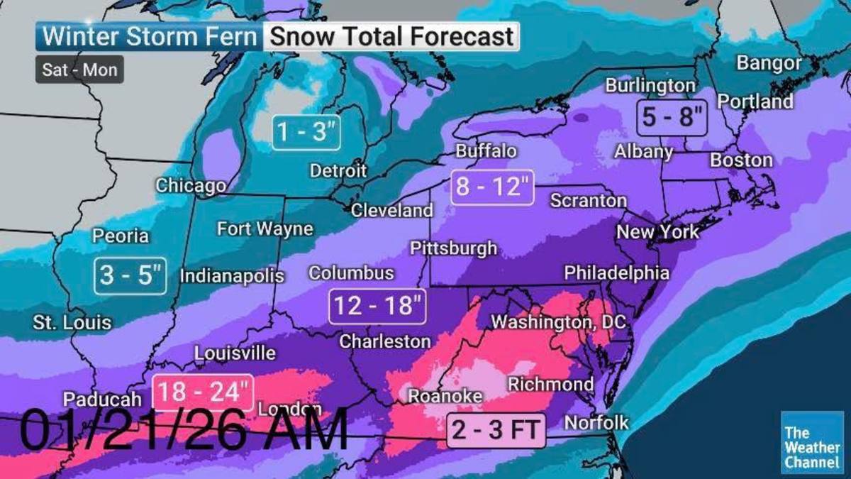
Blue Mountain/The Weather Channel
For now, all signs are pointing to a resounding yes. In the next one to five days, OpenSnow—a forecasting service popular among skiers—is calling for 19 inches of snow at Blue Mountain.
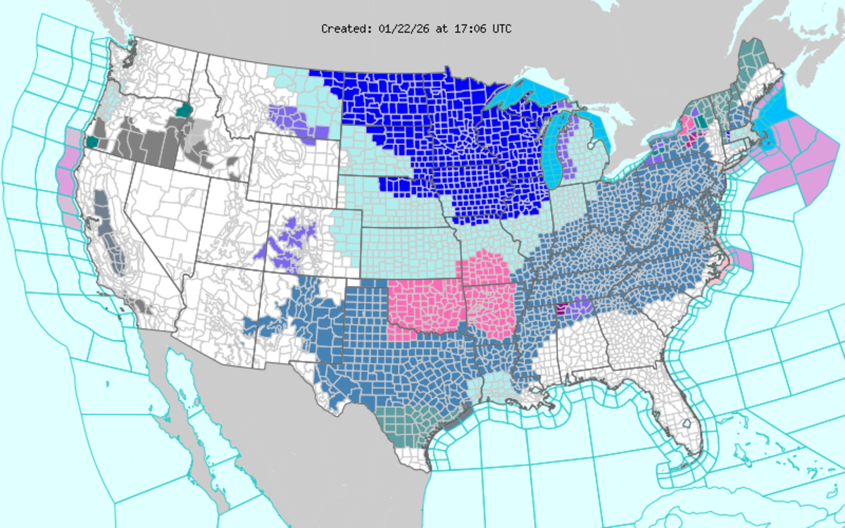
The National Weather Service is keeping tabs on the storm, too.
The agency has issued a winter storm watch that covers counties across Pennsylvania. It starts on Saturday evening and continues through Monday afternoon, bringing “Heavy snow and significant snow accumulations,” according to the National Weather Service.
The wintry weather is set to impact other areas in the Mid-Atlantic and East Coast. Throughout the Virginias, a slew of ski resorts, including Canaan Valley and Timberline, are slated for almost 30 inches of snow, according to OpenSnow.
National Weather Service
Widespread Snow, Ice, and Cold
The rest of the country is also watching their thermostats.
CNN reported that, as of Thursday, more than 120 million people were facing winter storm alerts, from extreme cold to ice storms. The forecasted band of precipitation and frigid temperatures stretches from the South all the way to the Northeast.
Around the Great Lakes, the mercury is plummeting well below freezing. In Texas, the governor has activated the state’s emergency response resources as snow, ice, and freezing rain approach.
“Confidence is high in a significant and impactful winter storm,” the National Weather Service noted in a forecast update on Thursday. The agency said that where sleet and freezing rain fall, there could be “long-duration power outages, extensive tree damage, and extremely dangerous or impassable travel conditions.”
Still, the National Weather Service added, “uncertainty remains in the exact storm track, timing, and placement of the heaviest snow and ice. Even small shifts could lead to large changes in local impacts.”
